Tuesday, February 3, 2009

Special Treatment of Lake Toba


History of Lake Toba :

Lake Toba, the largest fresh water like in South East Asia, and also considered lake in the world (± 500 meters) is located on the Northern side of the Barisan range, North Sumatra. The Lake stretches from the northwes to the southeas, with a length of 100 kilometers and a width of not less than 30 kilometers, and Samosir island right in the middle of it. The surface of Lake Toba is about 900 meters above sea level with a total area of about 110,260 hectares, almost twice the size of Singapore. The water catchment area around the Lake reaches 190,314 hectares while the area of Samosir island is 69,280 hectares.

The lake is located below the caldera of the Toba volcanic mountain, which erupted 75,000 years ago. Volcanologist predicted that it was the biggest volcanic eruption in history. Experts say that the eruption lasted approximately for two weeks, until the mountain finally collapsed and formed the caldera, which is now called Lake Toba. A research finding stated that the rhyolite dust, which is similar to an ignimbrite rock scattered around Lake Toba, is also found in Malaysia and on the bottom of the Bay of Bengal, around 3,000 kilometers from Toba.

Experts also stated that Lake Toba is a volcano-tectonic lake that was formed through subsidence. This means that the magma rose to the surface through a tectonic hole, and formed a volcano. The space left by the magma fomed a space inside the core of the earth, and formed a subsidence that was cut out into several parts. The large part is located in the middle, veering toward the west and formed Samosir Island. Other parts that were positioned lower formed into a lake.

The Lake Toba area is prone to earthquakes, since it is greatly affected by the large Sumatran plate. The Lake Toba region is classified as an E2-type according to the Oldeman classifications, and an A-type according to the Schmidt and Fergusson classification.

The type of land that dominates the water catchment area of Lake Toba is a Podsolic, Litosol, and Regosol that almost reach 97 percent of the total area.

Special Treatment of Lake Toba:

The Beauty of Lake Toba can’t be imaged only using a picture or sentence. It will be real if you look at by your self. A landscape of Lake Toba with the hills surrounding lake, make a fresh atmosphere and refresh the mind. The visitors sense it with swimming around. In afternoon, they can see the beauty of sun set.

Lake Toba has magic and cosmos since it believed as a place where Namborru (seven beloved ancestors of ethnic Batak) was stay. Before Ethnic Batak arranges costume ceremony around the lake, they ask to Namborru for permission, e.g. Toba Festival. There is any ceremonial to respect their ancestor.

In middle of Lake Toba, there is a land, called Pulau Samosir or Samosir Land. It have two Lake, they are Lake Sidhoni and Lake Natonang). They are lake on top of lake. Tourism object in Samosir are the resting place of king Sidaputar in Tomok Village and Traditional House of Batak Toba Samosir. The visitors can reach it using ship from Tomok Village, Samosir.

To reach Lake Toba, the visitors can use Medan-Prapat route or Medan-Berastagi using car or motorcycle about 4-5 hours.

Sapporo in Japan


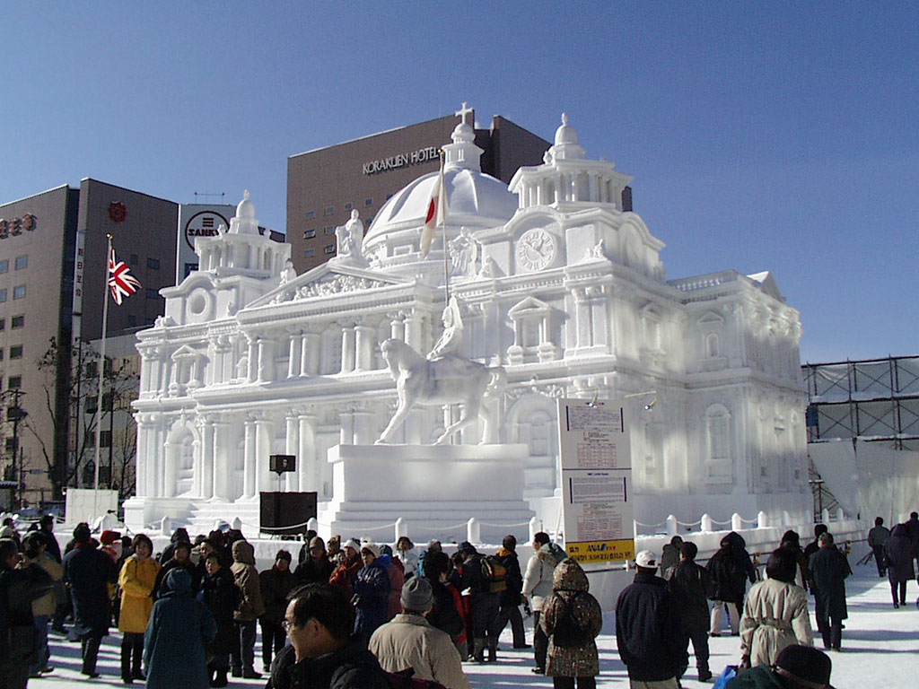
Sapporo White Illumination Picture..


Sapporo Show Festival Picture

History of Sapporo:
Sapporo is a very young city. Nevertheless, it spreads over 430 square miles, and is Japan's third largest city in area and fifth in population. It is the center of politics, commerce and culture for the major northern island of Hokkaido, and it is the hub of communications for all domestic and international travelers to the region.

Hokkaido, which was once called Ezo, was originally inhabited by the indigenous Ainu people, whose footprint can be found on the island in many of the place names. There are indications that Japanese settlers arrived on Hokkaido in the 7th century to trade with the Ainu, but it was not until 1821 that the Tokugawa Shogunate established a trading post on the Ishikari River, near present-day Sapporo.

In 1855, the Shogunate officially annexed the whole of Hokkaido and established government offices at Hakodate, on the south coast of the island. Two years later, two families moved into the Sapporo area and became the first official residents of the region. Soon after, the government changed the name of the island from Ezo to Hokkaido and serious colonization began.

The government established the Kaitakushi, or Development Commission, to plan and develop the island's resources. They decided to construct a capital for Hokkaido on the Ishikari Plain. Thus began the transformation of Sapporo from a small farming village into the major administrative center of Hokkaido. The Kaitakushi encouraged immigration by subsidizing transportation costs and providing food for settlers who were prepared to assist with defense preparations and development of the region.

The city planners created a green belt to divide the city into northern and southern portions. Today, Odori Park plays a major role in the seasonal events of the city by hosting major events such as the Sapporo Snow Festival, the Cherry Blossom Viewing and the Sapporo Summer Festival.

Construction took place at a furious pace. The Kaitakushi office was completed in 1871, with other government buildings, such as the Old Hokkaido Government Building (Akarengo) going up around it in the northern part of the city. Meanwhile, south of Odori Park, the commercial and entertainment districts started to take shape.

Settlers arriving from Honshu were encouraged by the Kaitakushi to introduce Western production technology for capital-intensive farming and to establish lumber mills, breweries and mines. To facilitate the introduction of technology, Sapporo Agricultural College was established in 1876. In the same year, Kaitakushi Brewery, Japan's first real beer brewery opened in Sapporo. The original Sapporo Brewery building is now home to the famous Sapporo Beer Garden.

In 1880, as the economy developed, based on raw materials and agriculture, Japan's third railroad was constructed to link Sapporo with Otaru, a major port to the west. Sapporo prospered as the city oversaw the transportation of agricultural produce, such as wheat, potatoes, corn and asparagus, as well as raw materials like timber and coal. Gradually, the city replaced horse-drawn trolley cars with electric streetcars.

The Hokkaido Government was established in 1886, and it quickly set about encouraging private investment in the region. An influx of businessmen from Honshu, followed by immigrants looking for higher paying jobs in the new territories, saw the area's population rise drastically from 1900 to 1920. Sapporo's post-war history is one of rapid growth and development as well, bringing the population to over one million by 1970.

Sapporo appeared on the world stage in 1972, when the city hosted the 11th Winter Olympic Games. To accommodate the Games, Sapporo instigated a development program that included construction of its subway system, underground heating for roads, and some of the best winter sports facilities available, including the fabulous Okurayama Ski Jump.

Adding to its reputation as a sporting city, Sapporo was a venue for group games in the 2002 Korea/Japan World Cup. In preparation for this, the city constructed the Sapporo Dome, a multipurpose venue that is one of the most modern stadiums in the country.

Sapporo is unlike any other Japanese city. It has wide streets, parks and green belts, and its sporting facilities are second to none. In such a short time, Sapporo has grown from a trading post to a city that is known throughout the world.

Source Article : http://uk.holidaysguide.yahoo.com/

Monday, February 2, 2009

The Best Opera House in Sydney


Description of Opera House :
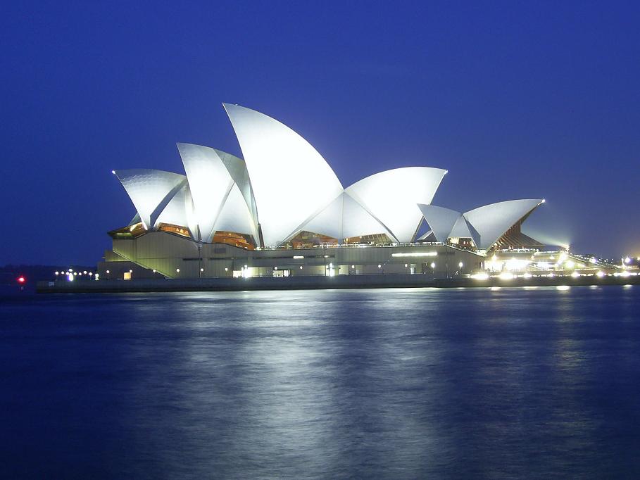
The Sydney Opera House is an expressionist modern design, with a series of large precast concrete 'shells', each taken from a hemisphere of the same radius, forming the roofs of the structure, set on a monumental podium. The building covers 1.8 hectares (4.5 acres) of land, and is 183 metres (605 ft) long and about 120 metres (388 ft) wide at its widest point. It is supported on 588 concrete piers sunk up to 25 metres below sea level. Its power supply is equivalent for a town of 25,000 people. The power is distributed by 645 kilometres of electrical cable.[citation needed]

The roofs of the House are covered in a subtle chevron pattern with 1,056,006 glossy white and matte cream Swedish-made tiles, though from a distance the tiles look only white. Despite their self-cleaning nature, they are still subject to periodic maintenance and replacement.[citation needed]

The Concert Hall is contained within the western group of shells, the Opera Theatre within the eastern group. The scale of the shells is chosen to reflect the internal height requirements, rising from the low entrance spaces, over the seating areas and up to the high stage towers. The minor venues (Drama Theatre, Playhouse, and The Studio) are located beneath the Concert Hall, as part of the western shell group. A much smaller group of shells set to one side of the Monumental Steps houses the Bennelong Restaurant. Although the roof structures of the Sydney Opera House are commonly referred to as shells (as they are in this article), they are in fact not shells in a strictly structural sense, but are instead precast concrete panels supported by precast concrete ribs.
Apart from the tile of the shells, and the glass curtain walls of the foyer spaces, the building's exterior is largely clad with aggregate panels composed of pink granite quarried in Tarana. Significant interior surface treatments also include off-form concrete, australian white birch plywood supplied from Wauchope in northern New South Wales, and brush box glulam.

Read More : http://en.wikipedia.org

Exotic Cancun Vacation in Mexico


This is a geat vacation in the world. This name is Cancun in Mexico. More People's can be travel in this place.

Beautiful Sunset at Parangtritis

Beautiful Sunset at Parangtritis Beach.....

Sunday, February 1, 2009

Enjoy InThe Toscana


Beautiful Toscana, Italy
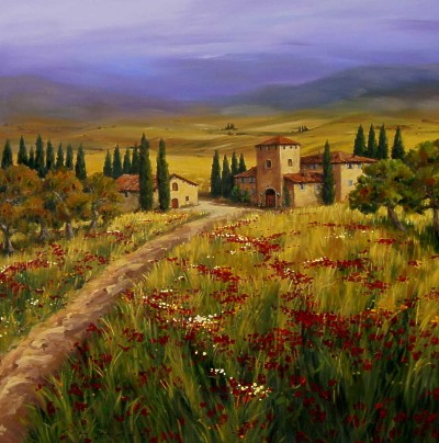
Tuscany (Italian: Toscana) is one of the 20 Regions of Italy. The capital is Florence, and it has an area of 22,990 km² and about 3.6 million inhabitants. Known for its landscapes and its artistic legacy, Tuscany is considered by some to be the most beautiful region in Italy. Six Tuscan localities have been made UNESCO protected sites: the historical center of Florence (1982), the historical center of Siena (1995), the square of the Cathedral of Pisa (1987), the historical center of San Gimignano (1990), the historical center of Pienza (1996) and the Val d' Orcia (2004).
Tuscany is a region of Central Italy, bordering Emilia-Romagna north, Liguria to the north-west, Tyrrhenian Sea to the west, Umbria and Marche to east, Lazio to the south-east. The territory is two thirds hilly and one fourth mountainous. The remainder is constituted by plains, that form the valley of the Arno River.
Read More in : theexcitingtraveldestinations.blogspot.com

Pattaya Beach in Thailand


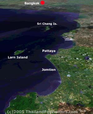
Pattaya beach in Thailand. This is a beautiful beach in Asia. The half-moon-shaped Pattaya Beach is 4 kilometres long with a road running parallel to the beachfront. From middle-section to the southern end of Pattaya Beach are many restaurants, bars, department stores, souvenir stores, as well as other places of entertainment. Khao Pattaya (Khao Phra Bat) is a small hill to the south of Pattaya Beach. The view point on the hilltop offers a panoramic view of Pattaya City and Pattaya Bay.