Saturday, March 21, 2009

Nicaragua Travel Destination


Wedge-shaped Nicaragua may be the largest country in Central America, but it is also one of the least visited. Even after more than a decade of peace, Nicaragua is synonymous in the minds of many with civil war; this reputation, when coupled with the dilapidated infrastructure of a country that has fought its way not only through a bloody conflict but also an American economic blockade, scares many off. Still, many travelers who spend any time there find - much to their surprise - that Nicaragua is their favorite country in the isthmus. Perhaps because it doesn't yet fully cater for the tourist experience, Nicaragua is an incorrigibly vibrant and individualistic country, with plenty to offer travelers prepared to brave Nicaragua's superficial obstacles of economic chaos, cracked pavements and crammed public transport.

Monday, March 16, 2009

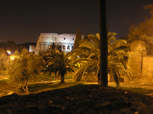
History of Colosseum in Roma, Italy

Construction of the Colosseum began under the rule of the Emperor Vespasian[1] in around 70–72AD. The site chosen was a flat area on the floor of a low valley between the Caelian, Esquiline and Palatine Hills, through which a canalised stream ran. By the 2nd century BC the area was densely inhabited. It was devastated by the Great Fire of Rome in AD 64, following which Nero seized much of the area to add to his personal domain. He built the grandiose Domus Aurea on the site, in front of which he created an artificial lake surrounded by pavilions, gardens and porticoes. The existing Aqua Claudia aqueduct was extended to supply water to the area and the gigantic bronze Colossus of Nero was set up nearby at the entrance to the Domus Aurea.
Although the Colossus was preserved, much of the Domus Aurea was torn down. The lake was filled in and the land reused as the location for the new Flavian Amphitheatre. Gladiatorial schools and other support buildings were constructed nearby within the former grounds of the Domus Aurea. According to a reconstructed inscription found on the site, "the emperor Vespasian ordered this new amphitheatre to be erected from his general's share of the booty." This is thought to refer to the vast quantity of treasure seized by the Romans following their victory in the Great Jewish Revolt in 70AD. The Colosseum can be thus interpreted as a great triumphal monument built in the Roman tradition of celebrating great victories.[11] Vespasian's decision to build the Colosseum on the site of Nero's lake can also be seen as a populist gesture of returning to the people an area of the city which Nero had appropriated for his own use. In contrast to many other amphitheatres, which were located on the outskirts of a city, the Colosseum was constructed in the city centre; in effect, placing it both literally and symbolically at the heart of Rome.
The Colosseum had been completed up to the third story by the time of Vespasian's death in 79. The top level was finished and the building inaugurated by his son, Titus, in 80.[1] Dio Cassius recounts that over 9,000 wild animals were killed during the inaugural games of the amphitheatre. The building was remodelled further under Vespasian's younger son, the newly-designated Emperor Domitian, who constructed the hypogeum, a series of underground tunnels used to house animals and slaves. He also added a gallery to the top of the Colosseum to increase its seating capacity.
In 217, the Colosseum was badly damaged by a major fire (caused by lightning, according to Dio Cassius[12]) which destroyed the wooden upper levels of the amphitheatre's interior. It was not fully repaired until about 240 and underwent further repairs in 250 or 252 and again in 320. An inscription records the restoration of various parts of the Colosseum under Theodosius II and Valentinian III (reigned 425–450), possibly to repair damage caused by a major earthquake in 443; more work followed in 484 and 508. The arena continued to be used for contests well into the 6th century, with gladiatorial fights last mentioned around 435. Animal hunts continued until at least 523.

Colosseum in Roma, Another Pictures


Look the exotic Colosseum Pictures

Saturday, March 7, 2009

The Best Travel Destinations of history Rhodes in Greece


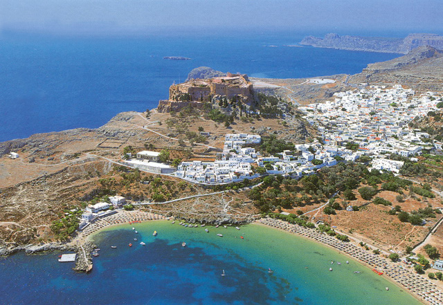
ACROPOLIS OF LINDOS Lindos is its rock
This rock, which rises to 116 m. forms the finishing touch to the landscape of Lindos, standing dry and imposing in its bareness and surrounded on all sides by the sea, so that Lindos ,may rejoice in the ocean, in the words of a hellenistic epigram. Lindos does not seem to have been particularly important in the earlier periods, though sporadic finds of the Neolithic period and the Bronze Age have been discovered on the acropolis. According to legend, the foundation of the sanctuary of Athena Lindia goes back to the Mycenaean period, and Mycenaean finds have been yielded by cemeteries in the broader area of Lindos. The Archaic period (7th-6th c BC) was a golden age for Lindos, which played a leading role in the Greek colonisation movement, its most important foundation being Gela in Sicily. The 6th c BC was dominated by the figure of a moderate tyrant, Kleoboulos who ruled Lindos for many years, and was Included amongst the �seven sages� of the ancient world.
During his rule, the Archaic temple of Athena was built on the site of an earlier structure, and the acropolis received its first monumental form. The Persian advance and later the merger of the three old cities into the new city of Rodos (408 BC) led to a diminution in the importance of Lindos as a political and economic power.
It nevertheless continue to be an important centre, focused on the famous sanctuary of Athena, which received its final monumental form in the Hellenistic period and became the leading sanctuary on the island. The acropolis was used as a fortress in antiquity, as well as In Byzantine times, in the period of the Knights of St. John, and in that of Ottoman rule.
Today, the ascent to the acropolis is still by the same steep road as in antiquity. After the first outer entrance to the medieval fortress, and before beginning to climb the large stairway that leads up to the Administrative Building of the Knights, we encounter two important monuments on our left a semicircular Hellenistic exedra, and, next to it, a depiction of the prow of an ancient ship carved in relief in the rock, which formed the base of a statue of Agesandros son of Milkion, the work of the sculptor Pythokritos in the early 2nd c. BC The fortification of Lindos by the Knights goes back to the 14th-15th c AD.
Passing through the ground - floor of the Knights Administrative Build Building, we emerge into a large square, which occupies the lowest level of the acropolis and was full of votive offerings in ancient times. A row of vaulted structures, built in the l st c. BC, stood on either side of a stairway leading up to the level of the large Hellenistic stoa, built ca. 200 BC. The large stairway behind the stoa leads up to the highest level where are to be found the Propylaia and the temple of Athena, which formed the main sacred precinct.The temple was completely isolated from the outside world by a wall with five entrances. In front of and behind it were stoas with rooms. The inner stoa flanked a courtyard in front of the temple, in which there was probably an altar. The temple, which measures about 22x8 m is a Doric, amphiprostyle tetrastyle structure. It was constructed in the 4th c. BC or in the early Hellenistic period on the site of Kleoboulos� temple, which had burned down in 392 BC. It stands at the highest point of the rock and was the culmination of the stepped vista offered by the stoa and the Propylaia to anyone ascending to the acropolis.

From the highest point of the acropolis can be seen the lower city, in which the most important monuments still visible are the theatre, the Tetrastoon and the Archokrateion at Kambana, a monumental tomb of an important Lindian family. The Byzantine church of the Panayia is also in the lower city. it was built It In the 15th c. and decorated with wall-paint paintings in the 17th and 18th c. The traditional settlement of Lindos is in a very good state of preservation. A large number of archontika (mansions) survive, the most Important of them from the 17th c., indicating that Lindos was a flourishing naval power in the early period of Turkish rule, as indeed throughout its entire history.
The Lindos Castle is found on the top of a 116m rock and serves as an entrance point to the Acropolis and the temple of Athena and once was used as the administrative building of the Knights. Today, the ascent to the acropolis Is still by the same steep road as in antiquity. After the first outer entrance to the medieval fortress, and before beginning to climb the large stairway that leads up to the Administrative Building of the Knights, we encounter two important monuments on our left a semicircular Hellenistic exedra, and, next to it, a depiction of the prow of an ancient ship carved in relief in the rock, which formed the base of a statue of Agesandros son of Milkion, the work of the sculptor Pythokritos in the early 2nd c. BC

The fortification of Lindos by the Knights goes back to the 14th-15th c AD. Passing through the ground - floor of the Knights Administrative Build Building, we emerge into a large square, which occupies the lowest level of the acropolis and was full of votive offerings in ancient times.
http://www.faliraki-info.com/lindos/history.htm

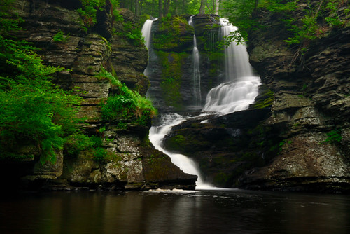
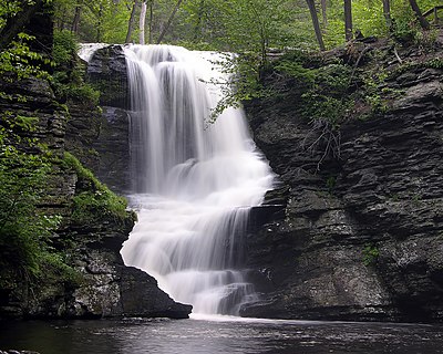
Exotic Fulmer Falls at Pennsylvania


A waterfall is usually a geological formation resulting from water, often in the form of a stream, flowing over an erosion-resistant rock formation that forms a nickpoint, or sudden break in elevation.Some waterfalls form in mountain environments in which the erosive water force is high and stream courses may be subject to sudden and catastrophic change. In such cases, the waterfall may not be the end product of many years of water action over a region, but rather the result of relatively sudden geological processes such as landslides, faults or volcanic action. In cold places, snow will build up in winter and melt and turn into a waterfall in summer

Friday, March 6, 2009

Milford Sound at New Zealand : Best Travel Destinations


Milford Sound (Piopiotahi in Māori) is a fjord in the south west of New Zealand's South Island, within Fiordland National Park and the Te Wahipounamu World Heritage site. It has been judged the world's top travel destination in an international survey, and is acclaimed as New Zealand's most famous tourist destination. Rudyard Kipling had previously called it the eighth Wonder of the World.
Etymology
Milford Sound is named after Milford Haven in Wales, while the Cleddau River which flows into the sound is also named for its Welsh namesake. The Māori named the sound Piopiotahi after the thrush-like piopio bird, now extinct. Piopiotahi means "a single piopio", harking back to the legend of Māui trying to win immortality for mankind - when Maui died in the attempt, a piopio was said to have flown here in mourning.
Geography

Milford Sound runs 15 kilometres inland from the Tasman Sea and is surrounded by sheer rock faces that rise 1,200 metres or more on either side. Among the peaks are The Elephant at 1,517 m (4,977 ft), said to resemble an elephant's head,[5] and Lion Mountain, 1,302 m (4,271 ft), in the shape of a crouching lion.[6] Lush rain forests cling precariously to these cliffs, while seals, penguins, and dolphins frequent the waters.
Climate

With a mean annual rainfall of 6,813 mm on 182 days a year,[7] a high level even for the West Coast, Milford Sound is known as the wettest inhabited place in New Zealand and one of the wettest in the world. Rainfall can reach 250 mm during a span of 24 hours.[8] The rainfall creates dozens of temporary waterfalls (as well as a number of major, more permanent ones) cascading down the cliff faces, some reaching a thousand metres in length. Smaller falls from such heights may never reach the bottom of the sound, drifting away in the wind.

Accumulated rainwater can at times cause portions of the rain forest to lose their grip on the sheer cliff faces, resulting in tree avalanches into the sound. The regrowth of the rain forest after these avalanches can be seen in several locations along the sound.
http://en.wikipedia.org/wiki/

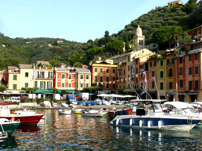
The Italian coastline Shot


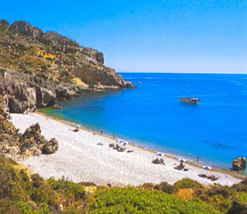
Arriving into the little village of Barissa just off the Italian coastline, I knew this was the perfect place for me to unwind and relax for a few days after spending to much time in big cities. This place is a very small village in the hills with only 1 shop and 1 restaurant and the mandatory church which rings the bell right on each hour including at ridiculous times of the morning. The few days I spent here were some of my favourite days of the trip so far and was a welcome escape from the hustle and bustle of Rome. While the area is still very heavily touristed this time of year was quite a good time to go as the weather was still perfect yet the summer crowds were long gone. The first day was spent hiking between each village, walking along the cliff faces that lined the bluest ocean ive seen. Each village was the typical Italian style village and it was a good opportunity to see people going about their everyday lives. The hike from one end to the other is only about 14km and is not all that difficult but makes you earn that beer at the end. For the other days of my stay I would get the train to one of the villages and just hang out for the day eating pizza and gelati and just watching the world go by. Saw an amazing sunset on the final day which was the perfect way to end my stay in this beautiful part of the world. Before I finish this entry I have to say that this is a must stop for anyone going to Italy but I think in summer the crowds would be to much to handle and would really take away from the experience. Speaking of crowds im off to Venice for a while before its time to take on the eastern European countries
http://www.travelpod.com/