Tuesday, March 31, 2009

The Beautiful Landscapes of Cayo Largo in Cuba


Cayo Largo del Sur, also known simply as Cayo Largo, is a small resort island belonging to Cuba, in the Caribbean Sea no more than 25 kilometers (15.5 miles) long and 3 kilometers (1.9 miles) wide. It is the second-biggest island in Cuba's Canarreos Archipelago.
Cayo Largo del Sur stretches along 27 km of virgin beaches with warm and crystal-clear waters. The sand is very fine, white and permanently fresh, characteristics which are unlikely to be found in another site in Cuba and rarely in the world. The always-turquoise sky contrasts magnificently with the white coral sand. The moderate tropical weather boasts an average temperature of 27c and has few rainfalls.
Tainos Indians lived here 800 years ago. This place is a natural kingdom of ecological beauty in perfect balance that is home to 350 iguanas, chelonian, pelicans, parrots, and herons. The sea contains colorful and varied fauna, as well as a 19 nautical mile coral reef where different kinds of black coral can be admired in less than 35 m of water. A diversified flora characterized by coastal vegetation and four species of mangroves decorate the old dunes and beaches.

Monday, March 30, 2009

More Pictures of Lake Tahoe in California


Beautiful Pictures of Lake Tahoe in California

Best Travel Destination of Lake Tahoe in California


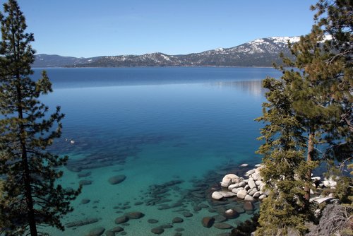
Lake Tahoe is a large freshwater lake in the Sierra Nevada mountains of the United States. It is located along the border between California and Nevada, west of Carson City, Nevada. Lake Tahoe is the largest alpine lake in North America. Its depth is 1,645 ft (501 m) making it America's second-deepest.

The lake was formed about 2 million years ago and is a part of the Lake Tahoe Basin with the modern Lake being shaped during the Ice Ages. The lake is known for the clarity of its water and the panorama of surrounding mountains on all sides. The area surrounding the lake is also referred to as Lake Tahoe, or simply Tahoe.

Lake Tahoe is a major tourist attraction for both California and Nevada. It is home to a number of ski resorts, summer outdoor recreation, and tourist attractions. Snow and skiing are a significant part of the area's economy and reputation. Mountain and lake scenery are attractions throughout the year. The Nevada side also includes large casinos. Highways provide year-round access from Reno, Carson City and Sacramento. Read full at http://en.wikipedia.org

More Pictures of St. Maarten


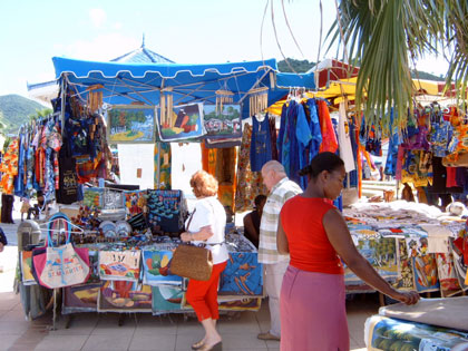
The Open-Air Market at Marigot

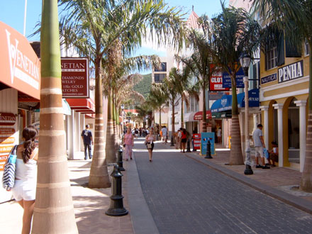
Eastern end of Front Street

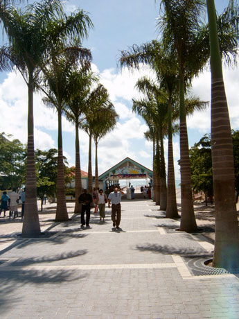
Wharf at The Center of Town, Front Street, Philipsburg


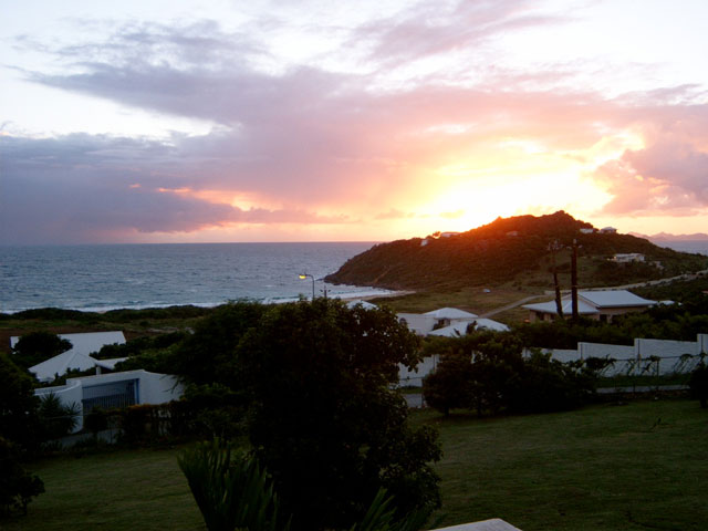
Sunrise at Guana Bay

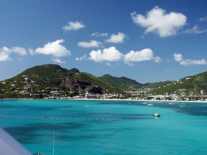
Philipsburg, the capital of Dutch St. Maarten


Philipsburg, the capital of Dutch St. Maarten, fills a narrow stretch of land between Great Bay and the Great Salt Pond. Founded in 1763 by John Philips, a Scottish captain in the Dutch navy, it soon became a bustling center of international trade. Today it is as bustling as ever, with lively shopping streets, cafes, and hotels.

Two main roads cut across the length of Philipsburg--Front Street and, yes, Back Street. Front Street, the main thoroughfare, is lined with duty-free shops offering everything from Italian leather goods and Japanese cameras to native crafts. Narrow alleyways lead in either direction to arcades and courtyards filled with flowers. Visitors will also find examples of traditional West Indian architecture, including characteristic pastel-colored houses with second-story verandas looking out over the street.

Front Street's most prominent landmark is the Courthouse, built in 1793. A grand white wooden structure topped with a cupola, it now serves as St. Maarten's courthouse. Also on Front Street is the Simartin Museum, which gives visitors an excellent introduction to local history. Among the artifacts on display are pottery from the island's original inhabitants, the Arawaks, and cargo salvaged from a British ship which sank off the coast in 1801.
Two historic forts bear witness to Philipsburg's strategic importance in St. Maarten's history. Fort Amsterdam, built in 1631 on a peninsula between Great Bay and Little Bay, was the first Dutch military outpost in the Caribbean. Unfortunately, it was soon captured by the Spanish, who made it their most important bastion east of Puerto Rico. The Spanish abandoned the fort in 1648, and since then it has remained in Dutch hands. All military operations ceased in the 19th century, although the fort was used as a signaling and communications station into the 1950s. A few walls of the original bastion remain, and the site provides an outstanding view of modern Philipsburg. Fort Willem, easily recognizable by its television transmission tower, lies just to the west of downtown. Built in 1801 by the British, it was taken over by the Dutch in 1816. It's an easy hike up to the fort, with a lovely panorama of Philipsburg and neighboring islands at the top.

Today, Philipsburg combines its historical legacy with 20th century excitement. Its waterfront has become a popular stop for cruise ships, and the town's many restaurants, cafes and night clubs offer entertainment well into the night. The town offers accommodations to suit every need, from modern resorts to intimate guest houses.
Source :http://www.geographia.com/

Monday, March 23, 2009

The Exotic Niagara Falls


The Niagara Falls are voluminous waterfalls on the Niagara River, straddling the international border between the Canadian province of Ontario and the U.S. state of New York. The falls are 17 miles (27 km) north-northwest of Buffalo, New York and 75 miles (120 km) south-southeast of Toronto, Ontario, between the twin cities of Niagara Falls, Ontario, and Niagara Falls, New York.

Niagara Falls is composed of two major sections separated by Goat Island: Horseshoe Falls, the majority of which lies on the Canadian side of the border, and American Falls on the American side. The smaller Bridal Veil Falls also is located on the American side, separated from the main falls by Luna Island. Niagara Falls were formed when glaciers receded at the end of the Wisconsin glaciation (the last ice age), and water from the newly-formed Great Lakes carved a path through the Niagara Escarpment en route to the Atlantic Ocean. While not exceptionally high, the Niagara Falls are very wide. More than six million cubic feet (168,000 m³) of water falls over the crest line every minute in high flow,[1] and almost 4 million cubic feet (110,000 m³) on average. It is the most powerful waterfall in North America.[2]

The Niagara Falls are renowned both for their beauty and as a valuable source of hydroelectric power. Managing the balance between recreational, commercial, and industrial uses has been a challenge for the stewards of the falls since the 1800s.
Article Source : http://en.wikipedia.org/wiki/Niagara_Falls

Saturday, March 21, 2009

The Excellent Places to Hike Around Las Vegas

Travel to Las Vegas and you'll likely hear plenty about nearby attractions like the Grand Canyon, the Hoover Dam, and Lake Mead. There are even places right on the Strip where you can take part in guided tours of these places. These highly publicized attractions are well worth it and have many interesting sights and are great ways to escape the lights of Vegas. But in addition to these high traffic tourist spots, there are a couple of not so highly publicized areas that are well worth your time, and cost no more than a rental car and a camera.

Red Rock Canyon is located about 15 miles west of the Strip. It is just outside of the city - you can take Charleston Boulevard all the way there. Charleston crosses the strip just north of the Stratosphere. Hop on Charleston and go west. Once you pass Red Rock Casino and Highway 215, you're almost there.

When you first get to Red Rock, there is a visitor's center where you can get out and check out some of the history of the canyon. You can learn about the Native American's who first lived in the area as well as the animals and plants that populate the canyon.

The canyon itself is made up of red sandstone which is very striking in color when the sun bounces off the canyon walls. There are numerous hiking trails that you can stop and hike. They range from easy to difficult. The canyon is also popular to rock climbers, who can often be seen scaling the cliffs and rocks of the area.

From the visitors center you can take the scenic loop, which is a 13 mile loop that winds its way through the canyon with numerous places to stop to either hike or take pictures. One of the stops along the loop is the Ice Box Canyon trail which is a two mile moderately difficult hike that includes some rock scrambling. This trail works it's way back into a canyon which is known for the cooler winds that blow through the rocks. While hiking be sure to look up the canyon walls as you can often see the climbers scrambling up their lines.

Along with the desert vegetation you're likely to see different animals in the conservation area. Bighorn sheep and deer accompany the wild burros that roam the land. The burros are rather tame and will often come up to car windows looking for food - though it is recommended not to feed them as this increases their independence on the tourists of the area. A picture of a burro sticking his head in your car window is often a great picture to share with friends back home.

The great thing about Red Rock is that you can see the sights without ever leaving the air conditioning of your car - or if you're feeling a little adventurous you can venture out on one of the trails and make your way a little off the beaten path. Even though you are just outside the sprawling city of Las Vegas, a trip to Red Rock is a great escape from the hustle and bustle of the city - a great way to take a vacation inside your vacation.

By: Patrick Treadway